Post With Label New York - Zeph1 Zeph1: New York - All Post
Showing posts with label New York. Show all posts
thumbnail

John Dolph - Akron, New York Historical Figure

John Dolph was a historic figure in the local Akron tale of Ah-weh-hah. He was involved in events that took place in Akron. Which includes events at Murder Creek. From historical record, he had moved to Akron some time in the 1820s. He and his wife aided Ah-weh-hah in escaping from a white man, named Sanders, who wanted to force her into marrying him. The story unfortunately ends in tragedy.

John Dolph (Find A Grave link)  was the husband of Sarah Dolph. He was born in 1781 and died on June 30, 1834. He was born in Luzerne County, Pennsylvania. Sarah Dolph was born in 1783 in New Jersey and died February 11, 1861. From known cemetery records they had two daughters. In the book, The life of General Ely S. Parker, the story says that they had a son. The son was likely Reuben J. Dolph. They may have had another son named Arthur Dolph. These records are as such:

Reuben J. Dolph 1826 - February 11, 1889
Arthur Dolph 1819 - 1891
Mary Ann Dolph 1811 - August 26, 1850
Susan Dolph 1813 - 1829

You can find more Dolphs from cemetery records, in Erie County, on Find A Grave
thumbnail

The Story Of Painted Post, New York

Painted Post, New York

What's In A Name?

How does a town get a name of "Painted Post?"  There's an easy answer to that...and a longer story.  The quick answer is the town was named after a post placed there by Indians. The real reason why the post was placed is not exactly known. But one speculation is that is was painted in a color combination suitable for some primitive type of communications. What's also not know is when the original was put in place.

The naming of this community in Steuben County, adjacent to Corning, NY, goes back to the Colonial Days and the Revolutionary War.  At that time, white men visiting the area found, on this very site, (the small park at the Community Square) an oak wood post which was square to a height of four feet and then octagonal to the top.  The surface was painted red and decorated with black figures, about half without heads.  There were numerous references to this "painted post" by the early settlers who found several explanations from the Indians who put it there.  For some it was regarded as a memorial to a fallen chieftain, for others a marker for assemblies and, a "war post" around which dances were held.

That original post endowed this place with a name which will endure as long as recorded history. By 1808, the first namesake had disintegrated and a fitting substitute was put up.  Since then there have been several other replacements and time, wind, and weather have taken their toll.  The present monument goes back to about 1950.

The Indian with the bow waves a greeting to visitors at the Community Square in Painted Post today, which is in the heart of the downtown business district.  It's not far from a major industrial property where an Allegheny field service team was working. During a lunch break, the pictures you see here were taken.


Important Points:

- Painted Post got its name from a post placed by Indians, though the exact reason for its placement is unknown.
- The town is located in Steuben County, adjacent to Corning, NY, and its naming dates back to the Colonial Days and the Revolutionary War.
- The original post found on the site was made of oak wood and had a square base that transitioned into an octagonal shape at the top.
- The post's surface was painted red and decorated with black figures, some of which lacked heads.
- Early settlers referred to the post as the "painted post" and attributed various meanings to its purpose, such as a memorial to a fallen chieftain or a marker for assemblies and dances.
- The original post deteriorated by 1808, leading to the installation of a replacement. Subsequent replacements were made due to the effects of time, wind, and weather.
- The present monument at Painted Post dates back to around 1950.
- In the heart of the downtown business district of Painted Post, visitors can find the Community Square, where an Indian figure with a bow waves a greeting.
- The Community Square is located near a major industrial property where an Allegheny field service team was working, as depicted in the accompanying pictures.


thumbnail

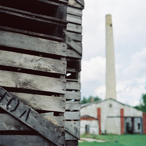
Photos from around Elba, Genesee County, New York.

For those that don't know, Elba is a small town in Western New York that's about halfway between Buffalo and Rochester. It's also a short distance away from Batavia, New York and a section of the NYS thruway. Elba is best known for its agriculture, its mucklands, and its well-developed community atmosphere. Find out more about the town by visiting this link here.


Crates
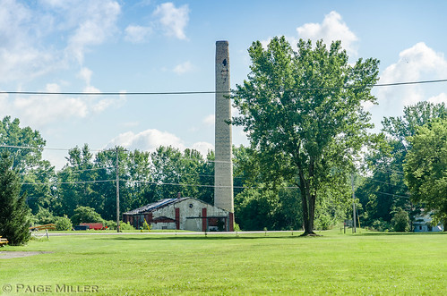
Smokestack and old, abandoned storage facility.

Elba, NY
Different shot of abandoned food processing and storage facilty, with smokestack.

Elba, NY
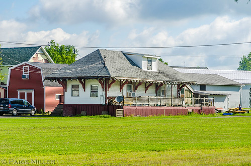
Old train depot that's now a pizza place. The tracks were removed in the late '80s.

Elba, NY
Elba Central School - Built in 1938

Elba, NY
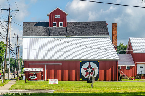
Barn currently housing a business called, "The Mill".

sky 019 sky 013
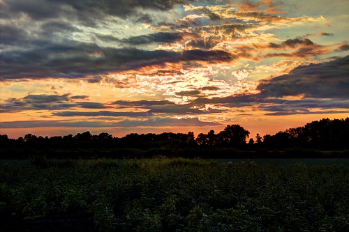
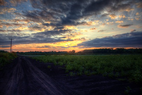
Serene field landscape at sunset

Related:
thumbnail

Rollin T. Grant Gulf Wilderness Park in Lockport, NY

The Rollin T. Grant Gulf Wilderness Park is a rare jewel of nature in the northwest corner of the city of Lockport! Here is New York State's only full nature preserve on the Niagara Escarpment. The Niagara Frontier's premier destination for flora, fossils, wildlife, and rock study... In a true wilderness environment!

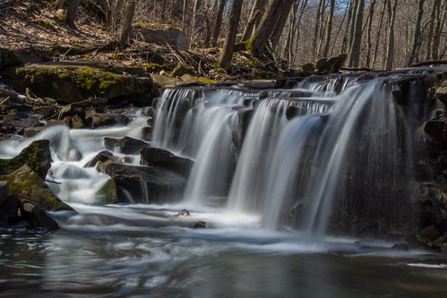
Indian Falls Gulf Wilderness Park


Features Indian Falls and numerous other natural sights.

The Rollin T. Grant Gulf Wilderness Park is a true, unspoiled wilderness. (Photo of sign at https://goo.gl/maps/4S67BVagrxP2) There are trails but little other accommodations of the modern life. The location is on the south side of West Jackson Street (near the 5900 block) where there is limited auto parking. Within the park is a millstone originally used in a 19th Century paper mill on the north side of the Erie Barge Canal in Lockport (at the present location of Upson Park). It was transported to this site in 1972 with a plaque attached to it to recognize the donation of seven acres at the park entry by the family of Josephine McCollum Carveth. The poem on the plaque reminds us to look here for English violets in early to mid April.

Map sign at the Park: https://goo.gl/maps/eowjXYDCVJF2

Overview and History

The Gulf Wilderness Park is a wooded ravine which was first cut out by a once raging river whose waters came from glacial melt during a warming cycle ten to fifteen thousand years ago. The glacier was formed during the latest of four glacial periods that covered much of North America and New York State two to three million years ago with ice sheets a mile or so thick.

The melting ice left vast bodies of water in the lowland. Glacial Lake Iroquois, the larger predecessor of Lake Ontario, was one. Its beaches are today represented by the plateau to the north of the escarpment here at Lockport.  In fact, U.S. Route 104 is built on the old beach ridge.

Glacial Lake Tonawanda lay to the south of Lockport between the Niagara Escarpment (goes through and divides Lockport) and the Onondaga Escarpment (which lies generally along Route 5 from the Buffalo city line through Amherst and Clarence--most dramatically noticed on Transit Road, heading north just past today's Eastern Hills Mall). The level plain between Lockport and Buffalo represents the bottom of Lake Tonawanda, with Tonawanda Creek being the remnant of the deepest part. Bear Ridge and Beach Ridge Roads were built along northerly dunes of the old lake.

Lake Tonawanda drained north into Lake Iroquois through outlet streams whose spillways eroded gorges through dolostone, shale, limestone, and sandstone strata.  The largest spillway was at Lewiston on the Niagara River (which eventually migrated south, developing into Niagara Falls). The second-largest spillway was here at Lockport and the Gulf Ravine is the exact location of this spillway. The third largest spillway out of the lake was near the present Cold Springs Road and the Lockport Town & Country Club golf course. There were lesser spillways to the east, including Gasport's Royalton Ravine and yet another just east of Medina. There was a slight west tilt to which favored more lake water going to the west.

As the level of Glacial Lake Tonawanda fell, flow of the outlets ceased except for local drainage and the Niagara River at Niagara Falls. With a greater initial flow the spillway at Lewiston-Niagara Falls cut more rapidly down the cap rock than falls at Lockport and points east. Finally when Lake Tonawanda fell below the level of the spillways at Lockport and points east, the falls here just dried up. Niagara Falls became the only outlet for the remains of Lake Tonawanda and for the output of the other Great Lakes.

The Alabama and Oak Orchard Swamps to the east and south of Lockport, and the overflowing ditches and creeks along roads in Amherst and Tonawanda during spring thaws are evidence that "old Lake Tonawanda" may not be completely drained yet. The West Branch of 18-Mile Creek, flowing through our Gulf Park, is all that remains of an ancient torrential stream.


Rocks and Fossils

Gulf Wilderness Park is an excellent location to study rock and formations and search for fossils.

Proof of the age of rock strata in Gulf Wilderness Park is found in the red sandstone surfaces of the Grimsby sandstone, where structures like intertwined ropes ("Arthrophycus") represent the fossil remains of worm burrows from the Silurian Period of about 430 million years ago. Fossils are also found in other rock layers in this park. One can look for crinoids, brachiopods, and corals.

Just east of the park property, along West Jackson Street, you can encounter an excellent display or two major rock formations being cut through in this area and notice the different weathering effect on each. The top layer is the "Medina group" of sandstone, while layers of (red) shale below it are of the Queenston group. As the shale begins to crumble it takes a course of turning into stone debris and eventually clay. The results can be easily seen at this location.

This stone display is equivalent to what you'd find through the Gulf ravine. At the bottom of the ravine, where most of the nature trails are routed, you'll find Grimsby sandstone formations and limestone.

John Keryk, who has explored this area intensively over the years advises fossil hunters, "Park near or at where the nature park is off West Jackson Street and head up-stream. The outcrops best are near stream level. Can also park by RR tracks. That used to be a good area for weathered fossils from the Clinton formation (at least until they re-graded the RR right of way). Still, west side of tracks one can find good examples of Clinton formation lying on the ground." See the map at the bottom of this page.

Wildflowers

The display of wildflowers and plants found in the park is unsurpassed in the area.  Spring, of course, is the best time to be looking for flowers. First come beautiful English violets. Also early are bloodroot, hepatica, and trillium. Later comes wild mint, leeks; then wild roses, jewelweed and doll's-eyes. Ferns are evident most of the year. In addition to the flowers, a wide variety of trees are found here.

Trees, Shrubs, & Vines

A wide variety of trees typical of the northeastern hardwood forest is found in Gulf Wilderness Park. Essential to the Gulf's life cycle are the many dead and dying trees. Birds, mammals, amphibians and reptiles are dependent in various ways on "snags" or standing dead trees. They are used for nesting, courting, mating, hibernating and as rich sources for foraging insects. Equally important are fallen logs that are essential for feeding, reproduction and protection. Fungi, algae and mosses thrive on the decaying wood.

Map Of Gulf Wilderness Park

Although you may enter Wilderness Park off of Niagara Street, near the railroad where the "parking" area is indicated on the map, the preferred entry for most will be off West Jackson Street. There are four separate nature trails through the park which are color-coded on a map at the entry points. The trails have no special individual significance except as reference points.


thumbnail

Clark's Gully Sacred Site in Naples, New York

Clark’s Gully Phoenix Rising Hi Tor (Naples), NY - Hi Tor Wildlife Management Area

This article was originally written by Madis Senner and speaks of Clark's Gully as being a sacred site going back to ancient times before Europeans set foot here. A place that's being 'brought back to life' with renewed interest in spirituality and "pre-colonial" history. The article is shared here for archival purposes.

One of the many places of Prayer in Upstate NY.

Clark Gully Parking Area

Clark's Gully, in Naples, NY and 15 miles south of Canandaigua
, at the southern end of Canandaigua Lake, has been a sacred site for a very long time. At the base of the gully one can find the visible remains (stones and rock formations) and the still glowing spiritual embers of several ancient civilizations. Clark's Gully provides the pilgrim with a unique opportunity to experience and add to the spirit of a variety of peoples that have prayed there before. It is also a testament to my belief that people are drawn to pray at the same place over and over again and that in doing so we add to the foundation of love and spirit placed there before.

Where the Seneca People Were Born

Clark's Gully lies at the base of South Hill, or Nundawao, where the Seneca people were born. According to legend it is at Nundawao that the earth divided and the Seneca people emerged. The Seneca’s refer to themselves as "Onodowaga," or "People of the Great Hill." The Senecas say that they were born at "Kanandague," or the chosen spot. This is from where Canandaigua Lake gets its name.

Clark's Gully is part of the NY DEC’s Hi Tor Fish and Wildlife Management Area. There are some other trails away from the gully. The gully itself is a very challenging climb with steep rock (shale) faces and covered with fallen trees. While the climb up South Hill along the ridge of the gully is challenging it is doable.

Spirit Keepers—Following the herd path along the creek, about a 100 yards up you will come upon several flat stones circled with round stones on your right--before the campfire area. I placed the stones to mark the sacred site. It sits on a stacked field of consciousness. As I have consistently stated the Spirit Keepers had an incredible knowledge of the earth, fields of consciousness and other earth phenomena and knew how to work with it all. They were extremely accurate in placing prayer/ceremonial sites on the most auspicious places, often on places of consciousness. This is also the case at Clark's Gully. The large manitou stone (East/right of the flat stones) was situated by them on a place of consciousness. Between the flat stones and large manitou stone there is a sacred circle surrounded by many of the original stones whose center is sunken.

Spend some time in meditation on the manitou stone, or other any other place in this field. This would be a great place to go if you are trying to sense consciousness.

Haudenosaunee—Right next to the spirit keepers site you will find two distinct wide and elongated piles of stones and a third one a little above the other two. They look like an extremely wide stone wall that has fallen down, they are not more than 6-12 inches high but are over 10 feet wide plus. They are in fact the remains of three long houses.

I have spoken to a few experts about this and they tell me that it is very rare and unusual to find a long house with a large stone component. This could have to do with the age and the special significance of Clark's Gully to the Seneca people. My dowsing rods traced out the spiritual embers (energy lines--prayer can attract energy and leave dowse able energy lines) of the long houses. You can find the remains of another long house just to the east at the top of the ridge, about 50 feet up.

Within the lodges there are the spiritual embers of several altars and sacred fires. Look for the larger stones. The greater part of both lodges are contained within the field of consciousness. If you don’t have dowsing rods look for larger flat stones to be possible altars. They would be a good place to do ceremony or meditate.

The large stone next to the spirit keepers site appears to have been a spirit keepers place and also located in the long house. Spend some time there or on one of the other larger stones.

Stone Circles—Just east of the long houses before the foot of the ridge you will see several groups of large (1-3 feet in height) stones. If you look closely you will notice that some of the stones appear to be grouped together in circles.

A dowsing of the stones, tracing out the energy lines, showed that they were in fact aligned in circles. There appears to be a total of 10 small circles there.

I could not determine the significance of why the stones were located there and not some place else other than the proximity to the Spirit Keepers Site and the stacked field of consciousness. I believe that the civilization that aligned the stones was pre-Haudenosaunee and post Spirit Keepers.

Stone Circles--There are several other sacred circles we have re-constructed using flat stones to replicate what was there previously. Do not be swayed by the campfires that can look like circles. Since we first posted Clark's Gully someone has created a small monument--no doubt influenced by the air of the place.

East of the recently constructed stone monument you will find the stone remains of a third long house. At the southern tip of the remains you will find an intact ceremonial circle.

Continuing up the mini ravine east of the third long house you will see a 2 ½ ft. high by 3 ft. in diameter stone that is part of a ceremonial circle. Continue walking up, you will shortly cross a herd path and you will see a large 2 ft. X 2 ft. stone that is 1 ft. high. It sits on a single field of consciousness.

Upper Clark's Gully--South Hill

There is a ridge above the creek bed that contains numerous sacred sites. You can either walk up the steep ridge next to stone circles or take the old dirt road that begins by intersection of Sunnyside and West Roads near the bridge. To read about those sites go to: Upper Clark's Gully-South Hill

More To Be Revealed

It is apparent that there is a lot more to Clark's Gully. My experience is that it takes time to know a place and that bits and pieces are revealed over time.

We found no distinct identity to the place. This may have to do with the smorgasboard of civilizations that have prayed at Clark's Gully and the spiritual neglect of several hundred years. The very strongly positive geographic samskara surrounding the stones is a testament to what went on there before. There is a very strong foundation of spirituality that we can build upon.

Finding Clark's Gully

To get to Clark's Gully take Route 364 south from Canandaigua. At Middlesex, you will turn right onto Route 245 going south, take a right on to Sunnyside, about 4.5 miles down 245. Just before you cross West End Avenue you will see a Hi Tor parking area—park there. You can continue for another 100 yards and cross West Avenue and park at the three un-marked parking areas just after West Avenue. You should be aware that the driveway-like parking areas are on private property. Clark's Gully is accessed near the intersection of Sunnyside Rd and West Ave in the town of Naples.

When we surveyed Clark's Gully on Labor Day weekend in 2007 it was bone dry.

Related Links:

http://hi-torstone.blogspot.com/

http://nyfalls.com/waterfalls/lower-clarks-gully/ - Read the section titled, "History" to view their take on the sacred site legend.

https://web.archive.org/web/20091021151114/http://geocities.com/falzguy.geo/clark-gully.html
thumbnail

Legend of Murder Creek in Akron, New York - The Tragedy of Ah-weh-hah

Murder Creek, Akron NY


Uriah Cummings
Uriah Cummings
The village of Akron, in Erie County, Western New York, has a rich history. Though a larger part of that history surrounds Murder Creek. One event in Murder Creek's history is about the murder of Nellie May Connors by 17-Year-Old Sadie McMullen on October 31st of 1890, when she threw the girl off a bridge across Murder Creek. McMullen also attempted to kill Delia Brown, but Brown survived the fall. It's also said that Sadie McMullen looked to commit suicide and wanted to take others with her. Sources: chroniclingamerica.loc.gov and Sadie McMullen. Another legend involving Murder Creek is fiction, an online-only story written by jxmartin

The main legend centers around a man named John Dolph, his wife, and Ah-weh-hah, as recounted in "The life of General Ely S. Parker: last grand sachem of the Iroquois and General Grant's military secretary" by Arthur Caswell Parker. It's said that the entry in A.C. Parker's book was from The Haunted Corners by Uriah Cummings. Read the comments at that link for more information and how to get a copy of the pdf.

Published Works of Erie County history and the history of Western New York

Also, an article scan in the Lockport, N.Y. Union-Sun And Journal, Thursday, January 4, 1968 - To read the PDF, visit https://fultonhistory.com/Fulton.html and search for: sun journal 1968 0057

In the spring of the early '20 's a white man named John Dolph came from the Mohawk country and built his cabin a stone's throw from the Wai-ont-hah. Here Dolph with Peter Van Deventer intended to build a saw-mill. 

On a certain October evening, Mr. Dolph spread his mill plans on his kitchen table in order to discuss them with his  good wife, who was rocking the baby boy in a cradle near the fire. Suddenly a piercing shriek was heard in the woods outside. The agonizing cry was repeated again and sounded nearer. Flinging open the door Dolph saw the figure of an Indian girl rushing toward his cabin. Dashing in, she fell to the floor moaning breathlessly, "Oh, save me, save me!" 

Dolph closed and barred the door and had no sooner done so than the burly voice of a man was heard and then the clamor of his fists on the door. "Let me in! Let me in!" he cried as he threw his weight against it. 

"You can't come in by trying in any such way," called out Dolph, at the same time motioning his wife to conceal the Indian girl. 

Mrs. Dolph lifted up a trap door and led the trembling girl into the mouth of a cavern. Dolph, with musket in hand, then advanced to the door and asked the intruder what business he had. 

"My name is Sanders," said the man, "and that girl is a prisoner, whom I am to deliver to the authorities at Grand river, Canada. Her father, a chief placed her in my hands, because she is wayward and wishes to marry a bad Indian. Now let me in, gentleman, please." 

Mr. Dolph unbarred the door and the stranger entered, looked around but saw no sign of his prey. Glancing upward he saw an attic opening and a ladder leading to it. Dolph handed him a lighted candle and somewhat nervously Sanders went up but soon came down, angry and excited. 

"Give up that girl, she's here, I saw her come in," he snarled. "Where is your cellar?" he asked, glancing down at the floor. 

Dolph removed a bit of carpet, handed the stranger a candle and bade him descend, but he found no trace of the girl and no visible outlet of escape, save to the room above.  He flew into a rage and muttering threats as he came up the ladder, "she shall not escape me; I shall find her yet," he exclaimed as he walked out into the darkness, to watch if he could any suspicious actions at the house. 

It was not long before he saw Mr. and Mrs. Dolph creep down the side of the gorge and enter a clump of bushes. 

Sanders had said that he was going to Canfield Tavern on the Buffalo road, and thus Dolph did not believe he was watched. He scanned the path, the woods and stream, but saw no one. A dark figure in the shadow of a great pine escaped his eye. So together the Dolphs went out and crept into the outside entrance of the cavern, which lay a few rods north of the falls, part way down on the right bank.  Looking around again in the darkness they satisfied themselves that they were unobserved. The October moon, though bright, could not pierce the depths beneath the autumn foliage. They entered the chamber, stooped low and crept on until they came to a high-arched cavern. There they saw the Indian girl, asleep from pure exhaustion. At the sound of a foot-fall she awakened and in wild-eyed alarm exclaimed, "Where is he?" Mrs. Dolph allayed the girl's fears and drew from her the story of her unhappy adventure. Mr. Uriah Cummings, long the local historian of Akron, relates this strange tale as he found it  in Mr. Dolph 's own records. We draw upon his version for the girl's story.

Lower Akron Falls in Winter (DTB_6139)

"My name," said the girl, "is Ah-weh-hah, which in the language of the pale-face is Wild-rose. My home is near Spirit Lake, under the cliff about a mile below the Tonawanda Falls. I live there with my aged father, who is a chief of the Senecas and his name is Go-wah-na, meaning 'The Great Fire.' 
"My mother has been dead several years, and my poor old father has just been murdered by that dreadful man Sanborn, from whom I had escaped when you opened your door and allowed me to enter. 

"For more than a year this dreadful man has been hovering around Spirit Lake trying to get a chance to  talk with me. He has urged me to marry him, but my Gray Wolf, my Tah-yoh-ne, is very dear to me and I was to become his wife very soon. But this man Sanders declared to me, that sooner than see me the wife of the Seneca brave, he would murder me and all who stood in his way. 

"My father, thinking to avoid trouble, said he would take me to the Cattaraugus Nation where I would be among friends and Tah-yoh-ne could join me there, and thus could we be free from the annoyance of Sanders' threats and entreaties. 

"I have had much to do to restrain Tah-yoh-ne from meeting this vile man Sanders. By much entreaty I have induced Tah-yoh-ne to do no harm to the wicked monster, for should they meet and should the pale-face fall, the authorities would not listen to anything we might say in defense of my brave Tah-yoh-ne. They would say he was guilty of murder and must be punished. 

"It was this morning that my dear father came to me  and told me to prepare for a journey to Cattaraugus.

"Soon all was ready and we started on foot, taking the old trail, the Wah-ah-gwen-ne, leading on to Te-os-ah-wah, a place called 'Buffalo' by your people. 

"We had reached the De-on-go-te Gah-hun-da and had sat down to rest and listen to the wondrous Gah-sko- sah-dah, when suddenly we saw the man Sanders close upon the trail behind us. 

"My poor aged father trembled with fear and apprehension, for he saw the look of wicked triumph in the hard face; and the offensive manner of the cruel intruder boded nothing but evil for us." 

After a brief interval in which the young Indian girl had indulged in paroxysms of grief and anguish, Mrs. Dolph had taken her hand and endeavored to soothe and quiet her, she at last continued her painful story. 

"Suddenly the entire manner of the man was changed. He seemed to have relented, and was sorry for his past conduct. 

"He smilingly came forward and extending one hand to my poor old father and his other hand to me, he said he wished us to banish from our minds entirely all thoughts of evil intent on his part; that he had made up his mind to cease trying to persuade me to marry him; that he hoped I would be happy with the brave Tah-yoh-ne; that he had decided to leave all behind him, and seek a home in the far West and there try to forget his great love for me; that he hoped all would be forgiven and forgotten; and that even now he was on his way to the great unknown West; he had not thought of seeing us again, but now that we were going in the same direction, he would do all he could to make us remember this journey with pleasure. 

"The man spoke so pleasantly that we were deceived as you shall soon learn. 

"My father was so pleased at the turn of affairs that he invited Sanders to journey as far as On-tar-o-ga, today; he said that as soon as we reached that 'place of hills and rocks' we would build our campfire, prepare our evening meal and there rest until morning. To all this Sanders readily assented. 

"And now as the details were settled, we lingered long at the De-on-go-te Ga-hun-da. 

"The moon came up bright and clear; the thunder of the Gah-sko-sah-dah came rolling down the valley and the time passed pleasantly, as Mr. Sanders can be very entertaining whenever he chooses to be. 
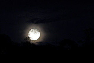
Moon Rising

"Finally we resumed our journey. We followed the Wah-ah-gwen-ne westward and came on up through the valley of the Wun-ne-pa-tuc and on up the trail leading westerly out of the valley, and on to the hills of On-tar-o-ga. Presently we came to the accustomed camping-place and soon we had a fire started and our evening meal disposed of, and my dear father sat before the fire contented and happy.

I had arisen and was looking eastward when I thought I saw a light across the head of the valley and not far away. At that instant I heard a blow struck, followed by  a groan, and quickly turning I saw my poor father lying prostrate on the ground, face downward, with that fiend Sanborn standing over him with an uplifted club in his hands. 

"With the look of a demon the brute sprang toward me intent upon murdering me also. With a shriek of despair and desperation I tied into the forest with the mad man close behind me, brandishing his club and vowing he would brain me. As I ran, it came to me about seeing the light through the trees, and as well as I could I fled in the direction of the light. I ran until I came upon the bridge over the Wun-ne-pa-tuc and there your light was in plain view, and I gathered up all my remaining strength and as I ran I cried, 'Save me,' when your door was suddenly opened for me with the fiend not ten steps behind me. You know the rest." 

Ah-weh-hah was a beautiful maiden, so the Dolphs thought, so during her story, they resolved to keep and protect her. She was tall, and her perfect teeth, her soft reddish brown complexion, her expressive black eyes and her long black hair betokened an Indian maiden of the finest type. Her refined manner and soft voice indicated that she had been carefully trained as a woman of the ho-ya-neh class.  

Mr. Cummings, who gives her conversation from the Dolph records, says it may seem incredible that this young Indian girl should have a command of English but he believes that Mr. Dolph 's records must be correct. The real answer is that Ah-weh-hah was a student in the mission school at Tonawanda. where the Seneca youth obtained the rudiments of an English education. 

The old chief, whose name no previous historian has given, was Big Fire, a veteran of the War of 1812. His body was found by Mr. Dolph in exactly the same spot as described by the girl. There too, he found the smouldering remains of the campfire. Ever since the day of his murder the cross-trail there has been known as the Haunted Corners. The spot is at the east side of Cummings Park. 

Dolph after his horrible discovery took the trail for his partner's tavern. When morning came Van Deventer and Dolph buried the remains of the victim of Sander's treachery. The murderer had taken the Buffalo stage at midnight. 

When Dolph returned home he found the Indian girl delirious. The news of the tragedy and of Ah-weh-hah's escape had reached the ears of the Indians and Tah-yoh-ne hastened to the refuge of his unhappy sweetheart. Ah-weh-hah was overjoyed at seeing Gray Wolf and begged that he go with her to the grave of her father. So together they journeyed over the trail until they stood by the newly made mound. Here, together they chanted the death song, as a last token of their affection. A grave fire was lighted and the sacred tobacco incense rose to lift the burden of their prayer to the Maker-of-All.  

While thus absorbed in their funeral devotions, a sudden step was heard and Sanders jumped from the underbrush, ax in hand. Wolf grabbed his tomahawk and then began a terrible struggle. Losing their weapons in the fray each grabbed their hunting-knives and tore each other's flesh until the blood ran down in gushing streams. Then came a pause and the white man fell backward, dead. 

Prostrate, and sickened by the awful sight, lay the girl. Wolf tried to speak but his lips were sealed. He was too weak to comfort his horrified sweetheart, and she too weak from the shock to rise to go to him. He staggered forward and fell. He too had perished at the graveside of her father. With an agonized cry that pierced the forests depths she gave vent to her horror and grief. Mr. Dolph heard the cry and ran the quarter mile to find what new tragedy had occurred. There he found the unhappy Wild Rose, on her knees, swaying back and forth as she moaned between her sobs the death chant. As she looked upward at Dolph her grief-stricken expression revealed such a depth of sorrow that he records that he felt her mind must soon give way. 

As she followed him back to his cabin his fears he found were realized. She was incoherent and dazed. Dolph, with the help of a neighbor, buried the two bodies, the Wolf near the Chief and the white man's a little to one side. 

Often the Wild Rose would visit the graves of her father and lover to weep and to chant her grief. Mr. Dolph recorded her song as he heard it : 

"Oh, my Gray Wolf, my Tah-yoh-ne, 
Do you hear the Wild Rose calling, 
Hear the song of your Ah-weh-hah, 
Hear her tell you how her heart aches? 
Why did not the brave Tah-yoh-ne 
Take his lonely Wild Rose with him. 
O, come back, my own Tah-yoh-ne, 
For my heart is breaking, breaking. 

You will wait for me, my Gray Wolf. 
For I soon shall come to join you. 
O, my Gray Wolf, my Tah-yoh-ne, 
Hear the voice of your Ah-weh-hah, 
Only wait a few days longer 
And I then will walk beside you."

When one day the Dolphs missed the Wild Rose they went out to the graveyard so tragically called into existence and there they found her, lying upon the grave of Gray Wolf, lying cold and lifeless. And so beside his grave they buried her. Many were the sincere tears they shed as their tender sympathies reached out in grief for the unhappy Ah-weh-hah.

Now as in former days the lover of midnight strolls may hear the voices of the two lovers as they wander over the modern dust of the ancient trail. The ghosts of the father and the murderers never come back to earth--they who come are only the spirits of the lovers whom destiny forbade a marriage in the earth life, but whom death united in a bond that the years have not broken. 
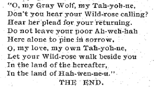
The Haunted Corners by Uriah Cummings
Excerpt from The Haunted Corners by Uriah Cummings
For many years the story of Big Fire's murder was told at the Parker fireside and the tale of the unhappy Ah-weh-hah never failed to bring tears to the eyes of those who heard it. It had one moral to the Indians; it was: "Look out for white man." But as ever, the warning was in vain^ for as the traditions run, "White man very cunning, he get you pretty soon." 

The tragedy of Ah-weh-hah was the tragedy of the people. The white man was on their trail. The "land sharks" had found them, and a life and death struggle for their homes was in progress. The child Ely passed quickly from the old stories, the ancient traditions of his people, to these new stories of wrong. As a child the need of a decisive action had often to be met, and it seemed to have found him ready. 

Because of the unhappy conditions among his people Ely, when ten years old, decided to run away. The whole nation was in the utmost confusion. By a system of high-handed fraud every foot of land the Seneca s had was signed away and the order came, "March West." The stoutest heart felt the clutching of emotions that could not "be concealed. There were bickerings and quarrelings and the people were in a pitiful situation. Ely did not wish to stay in a country where confusion, deceit and trickery existed. He resolved to go to Canada where the followers of Brant lived, and to join the Six Nations band on the  Grand river. His father consented and he went, accompanied by an older man, a friend of his father. 


Translated Meanings and/or Definitions:

De-on-go-te - Place of Hearing

Gah-sko-sah-dah - Name for the Akron Falls, previously called Falkirk Falls when the 'town' of Falkirk existed.

De-on-go-te Gah-hun-da / Murder Creek - Previous names: Sulphur Creek and See-Un-Gut (Roar of Distant Waters)

Wah-ah-gwen-ne - An old trail used by the Iroquois used to reach Buffalo (Te-os-ah-wah)

Wai-ont-hah - Beautiful Falls, Seneca name for Akron Falls

Wun-ne-pa-tuc - Mohegan-Algonkin name for Akron Falls, meaning "Beautiful Waterfall"

More about Ely Parker and regional WNY history and places of interest
thumbnail

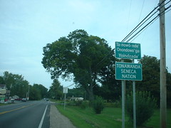
History of the Tonawanda Indian Reservation

The Tonawanda Reservation is located in Genesee County in Western New York and not far from the towns of Batavia, Elba, Oakfield, and Alabama. When I was younger, my father would sometimes take us on Sunday drives through the area and stop off at The Rez Smoke Shop to fill up the gas tank and buy stuff from the store. It's been a long time since I'd been there and their gas station has definitely been upgraded since then. If I remember correctly, they weren't a self-serve the last time we were through there, around 1998. It's strange, thinking back, how even these little experiences have formed who I am.

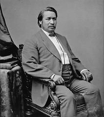
Ely Parker

Anyways, back on subject, the Tonawanda Reservation is settled by the Tonawanda Band of Seneca. Being federally recognized, they live by their traditional ways of governing. The treaty, which made them federally recognized, was the "Treaty with the Tonawanda Senecas." It was signed on November 5th, 1857, Ratified on June 4th, 1858, and Proclaimed on March 31st, 1859.

Former New York State Route 267


Charles Eli Mix, Commissioner of the Bureau of Indian Affairs at the time, represented the U.S. government and representing on behalf the Tonawanda Band were Seneca attorney and diplomat Ely Samuel Parker (Ha-sa-no-an-da), George Sky, Jabez Ground, Isaac Shanks, and Jesse Spring. Along with the treaty and being federally recognized, the land sales of the Treaties of Buffalo Creek were effectively reversed for the tribe and they were able to buy back the lands taken and sold by the Phelps and Gorham purchase.

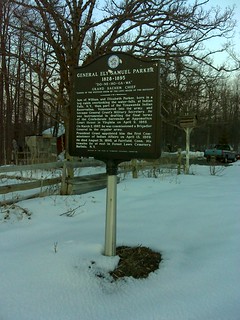
marker – Ely Parker birthplace

The Tonawanda Reservation is along the region where the border of the neutrals lived back before they were wiped out during the Beaver Wars. The first tribe to take a hit from the Iroquois (specifically, the Seneca) were the Wenrohronon. They suffered mass casualties in the attack, had their land taken and were forced to flee to Huron lands. It's hard to find any information about the Wenrohronon, as their tribe was absorbed and lost to time. These attacks by the Iroquois were carried out due to the influence of the Dutch in trying to disrupt French trading.

Little by little, the lands of the Tonawanda Reservation are being sold to surrounding interests. Though, it's said the Tonawanda Seneca are more lenient in allowing land to be sold to non-natives, in comparison to other bands of Seneca in the region. In 2015, the population was 458 but that number may not be accurate. In 2010, according to the Census, there were 693 residents.

Bloomingdale Road contains a good amount of businesses on the reservation, including the Rez (mentioned above). Some of the other nearby businesses include:

T P Deli & Fuel Outlet
Two Eagles Smoke Shop and Gas Mart
Joandy's
Sacajawea Smoke Shop

We are a participant in the Amazon Services LLC Associates Program, an affiliate advertising program designed to provide a means for us to earn fees by linking to Amazon.com and affiliated sites.
As an Amazon Associate I earn from qualifying purchases.
As an eBay Partner, I may be compensated if you make a purchase through eBay links on this site

Some articles on this blog may include AI-generated elements. While we strive for accuracy and relevance, please note that AI-assisted content may not always reflect the most current information. We recommend verifying important details independently to ensure accuracy

Subscribe for Updates: